Regional

The Category 3 hurricane, which had maximum sustained winds of 125 mph, was located about 5 miles south of Pinar Del Rio, according to the Miami-based forecaster.
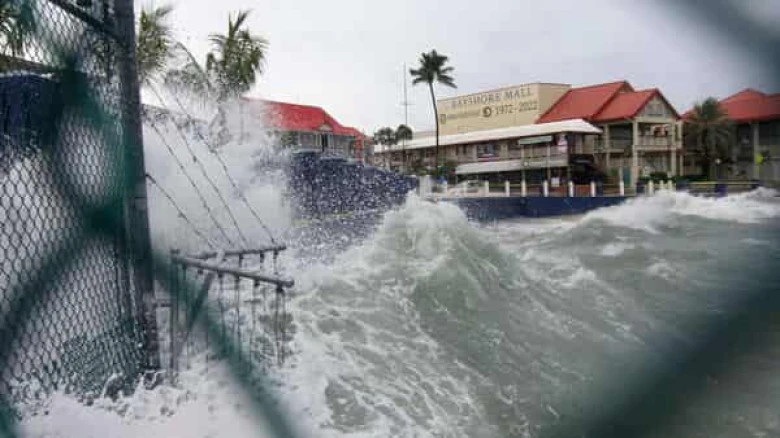
Digital Desk: The US National Hurricane Center (NHC) said that on Tuesday, Hurricane Ian made landfall over western Cuba and was on its way to Florida's west coast.
The Category 3 hurricane, which had maximum sustained winds of 125 mph, was located about 5 miles south of Pinar Del Rio, according to the Miami-based forecaster.
After emerging over the southeasterly Gulf of Mexico on Tuesday, Ian is predicted to gain power and intensify to Category 4 before it strikes the west coast of Florida, according to the NHC.
The NHC stated that regions of western Cuba should prepare for a potentially fatal storm surge, hurricane-force gusts, flash floods, and dangerous mudslides on Tuesday. It is anticipated that more than 300,000 individuals will leave.
"This is a situation where life is in danger, "the center's hurricane expert Brad Reinhart said in his report. Follow evacuation instructions as soon as they are given by local authorities."
Tuesday's anticipated arrival of tropical storm winds and Wednesday's arrival of hurricane conditions in Florida might result in major river flooding in the state's central regions.
Storms become "major" "or Category 3 status when their maximum sustained winds surpass 111 mph on the Saffir-Simpson scale.
According to the hurricane centre, portions of western Cuba could have up to 16 inches (41 cm) of rain by Thursday. Mudslides and flash flooding could happen. Miguel Diaz-Canel, the president of Cuba, forewarned the country on Monday that it will have a "difficult week."
Along Florida's west coast, Ian will ride. No matter where it strikes, the state will most certainly experience widespread consequences from the surge, wave, and rain, according to Ryan Truchelut, president of WeatherTiger.
According to the centre, the winds will reach their maximum speed of 140 mph late on Tuesday through Wednesday before decreasing to 120 mph on Thursday. In 36 to 48 hours, the storm will experience wind shear, which will prevent it from intensifying further.
However, according to Chuck Watson, a disaster modeller with Enki Research, Hurricane Ian might be the deadliest hurricane to hit Tampa in 101 years. Despite numerous recent near misses, the Tampa-St. Petersburg region was last severely damaged by a storm in 1921, which would have cost $30 billion in today's money.
More than half of the state's orange-growing land could see tropical storm-force gusts if Ian continues on its current course, according to Watson.
On Saturday, Florida received federal disaster help after President Joe Biden authorised an emergency designation for the state. Additionally, he cancelled a planned trip to the state on Tuesday that included a DNC event in Orlando.
Florida's governor, Ron DeSantis, issued a state of emergency and advised citizens to get ready.
Following Hurricane Fiona, Ian is the second destructive hurricane to smash over the Atlantic in less than a week. Fiona hit Atlantic Canada over the weekend, flooding parts of Nova Scotia and Prince Edward Island and doing considerable damage. According to Watson of Enki Research, the region's losses are estimated at $3.5 billion, but secondary effects like rain may cause expenditures to exceed $4.5 billion.
Leave A Comment