Regional
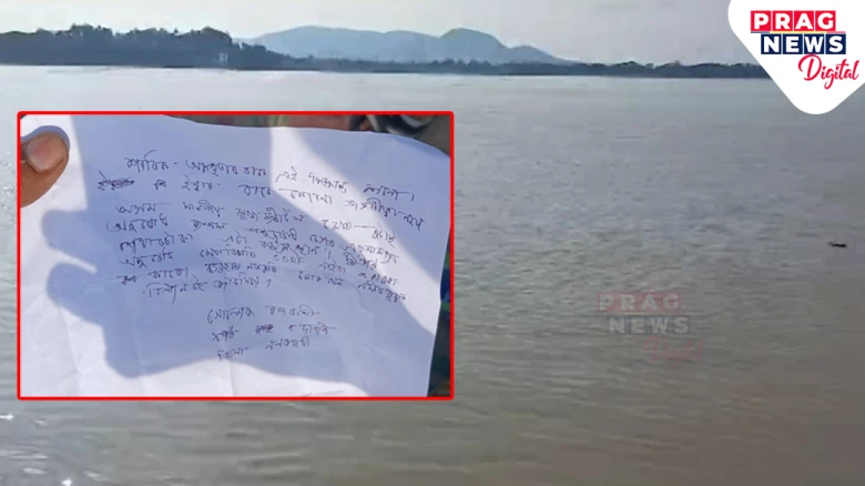
Rajbongshi expressed deep despair over his physical disability and highlighted the hardships he faced
Digital Desk: A heartbreaking event occurred on board the MV Bhagirathi ferry, which was travelling from Guwahati to Rajaduar in

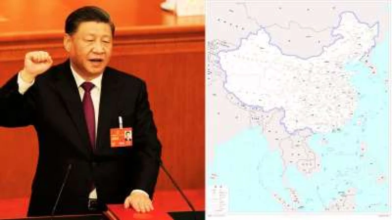
China has officially unveiled the 2023 edition of its "standard map," reaffirming its territorial claims over contentious regions...
Digital Desk: In a move that is likely to escalate tensions and trigger diplomatic concerns, China has officially unveiled the 2023 edition of its "standard map," reaffirming its territorial claims over contentious regions. The updated map, released on August 28, depicts Arunachal Pradesh and the Aksai Chin region as integral parts of China's territory. The map was made public during the celebration of Surveying and Mapping Publicity Day and the National Mapping Awareness Publicity Week in Deqing County, Zhejiang province.
China's map showcases Arunachal Pradesh, an area it claims as "South Tibet," and Aksai Chin, which China occupied during the 1962 war, as components of its sovereign land. This move continues to stoke tensions with neighboring India, which contests China's claims over these regions. The release of the map also solidifies China's grip on Taiwan and the disputed South China Sea, where its territorial ambitions clash with those of Vietnam, the Philippines, Malaysia, and Brunei.
Notably, the map reasserts China's controversial "nine-dash line" claim, effectively asserting control over vast expanses of the South China Sea. This action directly contradicts the claims and interests of several Southeast Asian nations, undermining regional stability and raising concerns about potential conflicts.
The unveiling of the map comes in the wake of a meeting between Chinese President Xi Jinping and Indian Prime Minister Narendra Modi on the sidelines of the BRICS Summit in Johannesburg, South Africa. During this meeting, Prime Minister Modi reportedly emphasized India's concerns regarding the unresolved issues along the Line of Actual Control in the Western Sector of the India-China border.
According to the Chinese state-owned newspaper China Daily, Wu Wenzhong, the chief planner of China’s Ministry of Natural Resources, highlighted the significance of surveying, mapping, and geographic information in driving the nation's development. Wu emphasized that these tools support various sectors of society, aid in the management of natural resources, and contribute to ecological and civilizational endeavors.
Wu further outlined China's plans to leverage geographic information data, including digital maps and navigation technologies, to fuel the development of the digital economy. This expansion into areas like location-based services, precision agriculture, platform economies, and intelligent connected vehicles aligns with China's broader ambitions to enhance its technological prowess.
The release of this updated map underscores the challenges posed by China's expansive territorial claims, prompting global leaders to closely monitor the evolving situation. As diplomatic dialogues continue, the international community remains watchful of any developments that could impact regional stability and security.


Leave A Comment