Mobile-based applications like Google Earth, Mapillary, NoteCAM/Conota Camera and GPS Essentials were introduced to help participants capture data in the field, record images and visualize landscapes in real time
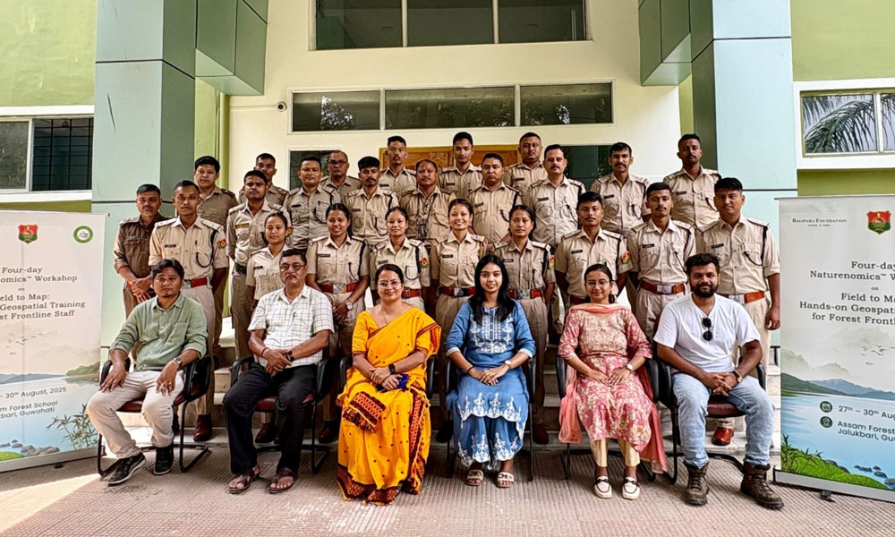
Digital Desk: The Balipara Foundation, in collaboration with Assam Forest School, Jalukbari, under the Department of Environment, Forest and Climate Change, Government of Assam, successfully conducted a four-day geospatial training workshop called as "Field to Map: Hands-on Geospatial Training for Forest Frontline Staff."
The workshop held from 27th to 30th August 2025, its aim was to empower frontline forest personnel in the region of Assam to have the necessary geospatial skills. Participants from region such as Dibru-Saikhowa National Park, Dhansiri Forest Division, Hailakandi, and Doom Dooma were part of the workshop, which combined field-based exercises with digital training sessions.
The training was dedicated on using freely accessible tools and applications to enhance forest protection and biodiversity monitoring. Participants were trained on how to use GPS equipment, to mark positions, to draw transects and measure areas. They also got to learn how to visualize information in such as Google Earth and they practiced to create polygons, measure distances, and mapping habitats.
Mobile applications such as Google Earth, NoteCAM/Conota Camera, Mapillary, and GPS Essentials were introduced for real-time data collection and landscape visualization. An interactive session in one of the Global Forest Watch sites demonstrated real-time forest monitoring methods, such as the use of GPS proximity alerts.
The final segment introduced QGIS, an open-source GIS software .The participants were taught how to interpret spatial data, how to transform KML/KMZ files into shapefiles, and how to build specific maps to aid in conserving planning over the long term.
Speaking at the workshop, Dimpi Bora, IFS, Director of Assam Forest School highlighted the growing demand and relevance of such capacity-building programmes, stating, “Training in GIS and GPS is one of the most sought-after skill sets for frontline forest staff. It is encouraging to see this knowledge being made accessible through practical, hands-on workshops like this.”
The workshop concluded with a certificate ceremony, leaving participants confident and better equipped to apply geospatial tools for safeguarding Assam’s rich biodiversity. This initiative aligns with Balipara Foundation’s Naturenomics™ vision—integrating ecological understanding into daily life to build resilient, nature-based communities in the Eastern Himalayas.
Continue Reading